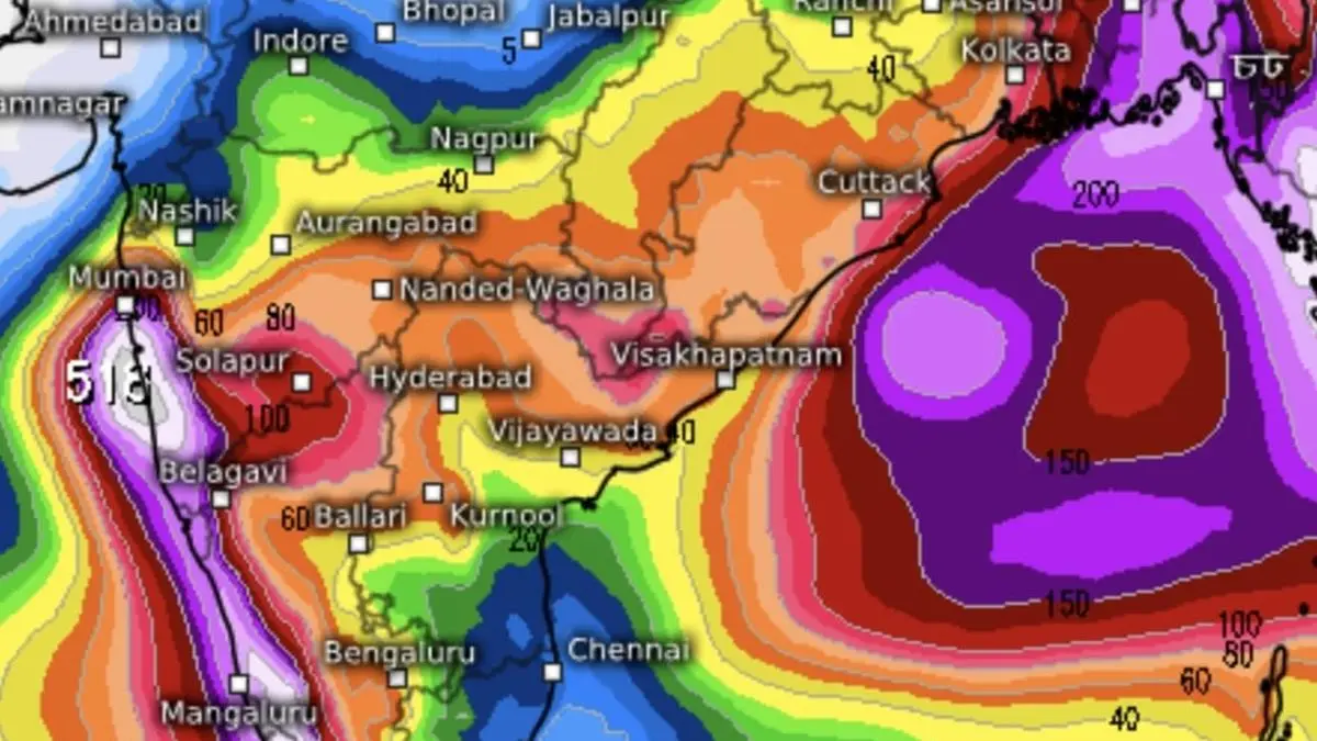
The west coast will continue to bear onslaught into weekend even as monsoon begins to pound East and North-East India, according to AI model of European Centre for Medium-Range Weather Forecasts.
Mumbai apart, some other places towards south on the west coast along Konkan, Goa and adjoining interior west Maharashtra as well as Coastal Karnataka may be bracing for some heavy rain.
These Anjanwel, Guhagar, Ganpatipule,Ratnagiri, Pawas and Kasheli with immediate threat as at 3 pm this (Monday afternoon). To a lesser degree Devgad, Achara, Malvan, Rajapur, Kharepatan, Talere, Oros and Sawantwadi will take hit.
This comes on the back of extremely heavy rainfall recorded at isolated places over Konkan, Madhya Maharashtra, Kerala and Mahe, Tamil Nadu and South Interior Karnataka during the 24 hours ending in the morning.
What is mainly driving the rains are a low-pressure area, remnant of erstwhile depression, over Marathwada and neighbourhood. An upper air trough runs from the cyclonic circulation associated with the ‘low’ to north-west Bay of Bengal across Chhattisgarh and Odisha.
Another cyclonic circulation lies over east-central Arabian Sea that links itself with the ‘low’ over Marathwada by a trough across south Konkan and Telangana, before accessing coastal Andhra Pradesh.
All these systems effectively slosh the South Peninsula with boatloads of moisture sourced from both the Arabian Sea to the west and the Bay of Bengal to east, finding expression in extreme heavy to heavy rain being reported.
It is into this super-saturated atmosphere that the Bay is threatening to throw up a low-pressure area as early as by tomorrow (Tuesday), India Meteorological Department (IMD) said, retaining this outlook for many days together.
More Like This
Published on May 26, 2025